Manual and short describtion of BalloonRadar's features.
NAVIGATION
There are several features we shall describe in this chapter. All of them serve to navigate, rather evaluate the weather and predict your flight.
1. GREEN LINE / RED LINE
Green line is a basic feature which provides you with all information about your flight. It is time- and speed-responsive prediction of flight. The length constantly adjusts to show the position of your balloon after 30 minutes. Of course, the angle of inclination reflects your flight's direction.
Red line is your track. It shows the exact path of that you have followed.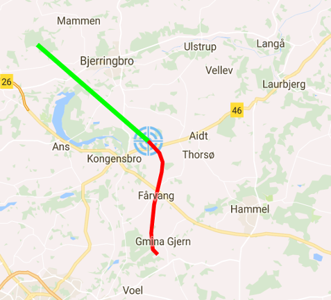
2. FLIGHT PARAMETERS
The top black portion of your screen features various parameters: flight speed, flight direction, current altitude, flight duration and distance flown.
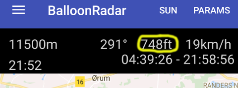
1. Altitude - can be displayed in either meters or feet (you can change your preference in settings)
2. Direction is shown as heading direction in degrees.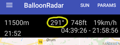
3. Speed - you can change your unit preference to m/s, km/h, or knots.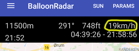
4. Current flight time in minutes.
5. Distance of flight - (displayed in meters) measured from your take off place to your current postion.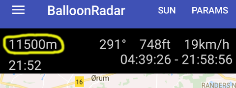
Some of the flight parameters can be hidden by switching "PARAMS" mode.
3. Your point on the map
You can choose any point on the map that you intend to reach by pressing that place and holding your finger on the map for 1 second. BalloonRadar will calculate how much time you need to reach this point with the current speed. Imagine: you need to decide go over the forest or land before. It's easy - after setting your first landing place behind the forest, our app will tell you when you will get there. The estimated arrival time will be recalculated every second, taking into account your current parameters, in order to provide you with the most accurate data.
Note: The calculation is based on the speed, not the direction of your flight.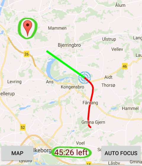
4. SUNSET / SUNRISE
By activating "SUN" mode, youwill be able to see the time of sunrise and sunset at your location. These values are always given at the time zone in which your device is operating.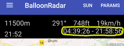
5. SAT/MAP VIEW
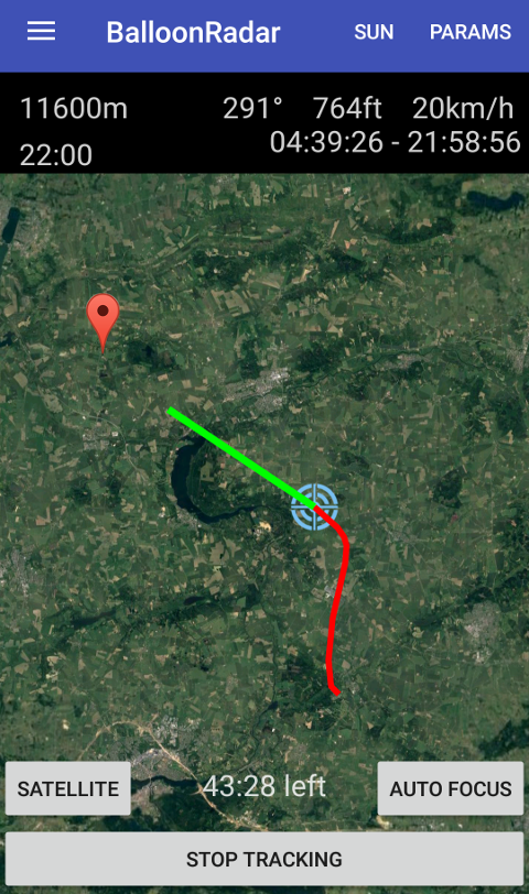
You can switch view mode between satelite and map. Satelite can be useful just before landing to check, for example, field availability. To switch, simply press map/sat button.

6. AUTO ZOOM
Autozoom is a perfect feature for pilots who don't wish to be occupied by operating an app during the flight. Autozoom always adjusts your screen to the current speed and direction. In fact, when you fly high and fast, BalloonRadar will show your predicted flying route, and when you go down and slow down, your map will be automatically bigger to show you all details. Autozoom is turned on by default, but you can turn it off by pressing manual/auto focus.
ALL YOUR FLIGHTS
You can go through all of the flights that you have performed. Your device will remember their data. You can easily delete some of them from your device. Even if you do it accidentally, you will be able to retrieve the information as its copy will be saved in our cloud. Your device will save:
1. Date of flight
2. Time of start and landing
3. Max altitude
4. Distance flown
5. Max speed
6. Flight's path on the map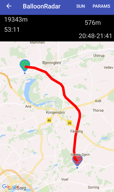
MAILING LIST
BalloonRadar is capable of notifying your entire crew and passengers about the start and landing positions of your balloon through e-mail. All you need to do is to enter the email addresses by selecting "Mail list" in Settings menu.

Change log:
16/03-2018
![]()
- Start screen. An extensive database required us to implement a different application construction. Loading the application takes a little longer but thanks to that we could add a screen with a photo. The loading bar informs you about the loading progress over the photo at the top of the screen. This screen will be used for advertising in the future.The screen goes out after about 5 seconds depending on the connection speed.
- Profile screen. It is a screen informing about the User. You will see on it what others see, watching your flight. So a photo of your balloon, registration marks and your name and surname (your name and surname are not visible on the website, it is information only for you and your driver).This screen turns off when you touch the screen anywhere.
- Settings: We have added several functions to the settings:
- at the request of Pilots from the USA we have introduced a change in the selection of units. From now on you can use miles in distance and miles per hour at speed
- hiding activity on the public side. Some of you are eager to use BalloonRadar but do not want to be seen in public. From now on you can use this function and your flight will only be visible in the BalloonRadar_Drive application by your driver. However, hiding a flight has a direct impact on the mailing function. If your flight is hidden and the application sends an e-mail to your relatives about the take-off and landing, from now they will not be able to see the place of take-off and landing on the map.
- We have improved the visibility and calculation of the time to reach any point. From now on, when you choose any point on the map, keep your finger on it for 1 second. The app will instantly calculate how much time you need to get to this point. This information will be provided on the bottom bar that will cover the landing button. To report a landing, it will now be necessary to disable the selected point with the dissmiss button.
- We've introduced the visibility of the driver using BalloonRadar_Drive. From now on, the pilot knows exactly where his car is. If several cars follow him, he sees them all. The condition is that each of them must use BalloonRadar_Drive.We have changed the image of the application. We have improved buttons, colors, readability and transparency.

- We've added the application load screen where future ads will be visible for about 5 seconds.
- After going to the list of pilots, above the list you can see information about the login you are using.
- After selecting the balloon you want to go to, its profile is visible for about 3 seconds. At this time, the application loads data from the database.
- On the main screen, we have changed the location of the information to make it more readable. The upper bar is information about the balloon flight - its speed, direction, altitude and time in minutes how many minutes since the balloon was last logged into the server. The left side remains unchanged, ie the distance in meters from the balloon and flight time. The status of the balloon was shifted to the lower left corner. Satus "Air" means that the balloon flies and the status "Ground" that he landed.
- We have changed the appearance of the buttons to make them more legible and refer to the remote control application.